Weather Alert in New Mexico
Flood Advisory issued May 8 at 8:14AM MDT by NWS Albuquerque NM
AREAS AFFECTED: Rio Arriba, NM
DESCRIPTION: ...The Flood Advisory continues for the following rivers in New Mexico... Rio Chama Below Chamita affecting Rio Arriba County. .Snow melt and increased reservoir releases will cause the river flows to become high. Expect minor flooding downstream from the dam. * WHAT...Flooding caused by snowmelt continues. * WHERE...Rio Chama below Chamita. * WHEN...Until further notice. * IMPACTS...At 6.0 feet, Properties in the flood plain along the Rio Chama and near the junction of the Rio Ojo Caliente will see water in their yards. Impacts can include bank erosion and damage to wells and septic tanks. These impacts will increase in severity at higher river levels. At 5.5 feet, Bankfull stage. Properties immediately adjacent to the river upstream of the bridge on SR-74 and especially near the junction with the Rio Ojo Caliente may see water encroach onto low lying areas. * ADDITIONAL DETAILS... - At 7:00 AM MDT Wednesday the stage was 5.7 feet. - Bankfull stage is 5.5 feet. - Forecast...The river is expected to rise to a crest of 5.8 feet this evening. - Action stage is 5.5 feet. - Flood stage is 6.0 feet. - http://www.weather.gov/safety/flood
INSTRUCTION: Caution is urged when walking near riverbanks. Additional information is available at www.weather.gov/abq. The next statement will be issued Thursday morning at 1000 AM MDT.
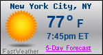
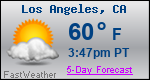
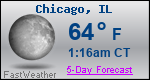
Want more detail? Get the Complete 7 Day and Night Detailed Forecast!
Current U.S. National Radar--Current
The Current National Weather Radar is shown below with a UTC Time (subtract 5 hours from UTC to get Eastern Time).

National Weather Forecast--Current
The Current National Weather Forecast and National Weather Map are shown below.

National Weather Forecast for Tomorrow
Tomorrow National Weather Forecast and Tomorrow National Weather Map are show below.

North America Water Vapor (Moisture)
This map shows recent moisture content over North America. Bright and colored areas show high moisture (ie, clouds); brown indicates very little moisture present; black indicates no moisture.

Weather Topic: What are Altocumulus Clouds?
Home - Education - Cloud Types - Altocumulus Clouds
 Next Topic: Altostratus Clouds
Similar to cirrocumulus clouds, altocumulus clouds are
characterized by cloud patches. They are distinguished by larger cloudlets
than cirrocumulus clouds but are still smaller than stratocumulus clouds.
Altocumulus clouds most commonly form in middle altitudes (between 2 and 5 km)
and may resemble, at times, the shape of a flying saucer.
These uncommon formations, called altocumulus lenticularis, are created by uplift
in the atmosphere and are most often seen in close proximity to mountains.
Next Topic: Altostratus Clouds
Weather Topic: What are Cirrocumulus Clouds?
Home - Education - Cloud Types - Cirrocumulus Clouds
 Next Topic: Cirrostratus Clouds
Cirrocumulus clouds form at high altitudes (usually around 5 km)
and have distinguishing characteristics displayed in a fine layer of
small cloud patches. These small cloud patches are sometimes referred to as
"cloudlets" in relation to the whole cloud formation.
Cirrocumulus clouds are formed from ice crystals and water droplets. Often, the
water droplets in the cloud freeze into ice crystals and the cloud becomes a
cirrostratus cloud. Because of this common occurrence, cirrocumulus cloud
formations generally pass rapidly.
Next Topic: Cirrostratus Clouds