Weather Alert in Maine
Beach Hazards Statement issued August 2 at 8:10AM EDT until August 2 at 6:00PM EDT by NWS Gray ME
AREAS AFFECTED: Knox; Coastal Waldo
DESCRIPTION: * WHAT...Temperatures in the 70s may cause people to underestimate the dangers of water temperatures which are currently in the mid to upper 50s in and around Penobscot Bay.. * WHERE...Knox and Coastal Waldo Counties. * WHEN...Until 6 PM EDT this evening. * IMPACTS...The cold water temperatures can quickly cause hypothermia to anyone immersed in the water. When the water temperature is below 60 degrees, the average submerged person could lose dexterity within minutes and be unable to accomplish simple tasks. Anyone on boats or paddlecraft should use extreme caution to avoid this threat.
INSTRUCTION: A Beach Hazards Statement is issued on days when a significant number of boats and paddlecraft are expected to be out on the water and when warm air temperatures may cause people to underestimate the danger of the cold water. Paddle smart from the start. Always wear your life jacket. Be aware of wind conditions, tides, and localized currents. All boaters and paddlers are highly encouraged to contact the U.S. Coast Guard Auxiliary or U.S. Power Squadrons at www.wow.uscgaux/i_want_a_usc/index.php to receive a FREE vessel check. This is a convenient, no consequence way to ensure your vessel is outfitted with all required safety equipment. Additionally, please label your paddlecraft with your contact information (IF FOUND Sticker) in the event it is found adrift on the water.
Want more detail? Get the Complete 7 Day and Night Detailed Forecast!
Current U.S. National Radar--Current
The Current National Weather Radar is shown below with a UTC Time (subtract 5 hours from UTC to get Eastern Time).

National Weather Forecast--Current
The Current National Weather Forecast and National Weather Map are shown below.

National Weather Forecast for Tomorrow
Tomorrow National Weather Forecast and Tomorrow National Weather Map are show below.

North America Water Vapor (Moisture)
This map shows recent moisture content over North America. Bright and colored areas show high moisture (ie, clouds); brown indicates very little moisture present; black indicates no moisture.

Weather Topic: What are Stratocumulus Clouds?
Home - Education - Cloud Types - Stratocumulus Clouds
 Next Topic: Stratus Clouds
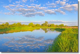
Stratocumulus clouds are similar to altocumulus clouds in their
fluffy appearance, but have a slightly darker shade due to their additional mass.
A good way to distinguish the two cloud types is to hold your hand out and measure
the size of an individual cloud; if it is the size of your thumb it is generally
an altocumulus cloud, if it is the size of your hand it is generally a
stratocumulus cloud.
It is uncommon for stratocumulus clouds to produce precipitation, but if they do
it is usually a light rain or snow.
Next Topic: Stratus Clouds
Weather Topic: What are Wall Clouds?
Home - Education - Cloud Types - Wall Clouds
 Next Topic: Altocumulus Clouds
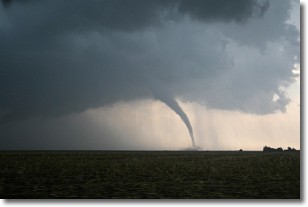
A wall cloud forms underneath the base of a cumulonimbus cloud,
and can be a hotbed for deadly tornadoes.
Wall clouds are formed by air flowing into the cumulonimbus clouds, which can
result in the wall cloud descending from the base of the cumulonimbus cloud, or
rising fractus clouds which join to the base of the storm cloud as the wall cloud
takes shape.
Wall clouds can be very large, and in the Northern Hemisphere they generally
form at the southern edge of cumulonimbus clouds.
Next Topic: Altocumulus Clouds
Current conditions powered by WeatherAPI.com


