Weather Alert in Alaska
Flood Advisory issued August 30 at 12:33AM AKDT until August 31 at 2:00AM AKDT by NWS Anchorage AK
AREAS AFFECTED: Lower Matanuska Valley; Sutton / Upper Matanuska Valley
DESCRIPTION: * WHAT...Flooding caused by previous excessive rainfall is expected. * WHERE...Matanuska River. * WHEN...Until 200 AM AKDT Sunday. * IMPACTS...River levels have exceeded those observed in early July and early August, and increased bank erosion is expected along the lower Matanuska River. Minor flooding is expected in low-lying and poor drainage areas along and near the Matanuska River. * ADDITIONAL DETAILS... - At 1221 AM AKDT, river gauge reports indicate rises in water levels from previous days heavy rain across the advisory area. This will cause minor flooding from overflow of poor drainage areas, especially along and near the Matanuska River. - Impacts: At 15000.0 cfs: Action Flow - This discharge (flow) level represents the higher end of the typical summertime range, and will likely be reached at least once nearly every year. Localized minor out-of-bank flooding may start to occur along parts of the Glenn highway, especially east of Sutton from milepost 64 to 66. At 30000.0 cfs: Minor Flood Flow - This discharge (flow) level has a roughly 20 percent chance of being reached in any given year. Additional vulnerable locations near the active river channel may experience some flooding at this level west of the Old Glenn Highway in the Butte and near Sutton from Milepost 64 to 66. Residents are advised that for the past several years at both of these locations, the main channel of the river has been shifting closer to the bank. At 35000.0 cfs: Moderate Flood Flow - This discharge (flow) level has a roughly 10 percent chance of being reached in any given year. Flooding near vulnerable locations along the active river channel may become more significant and widespread. This level was reached during the flooding in 2012. - For Matanuska River at Palmer: At 11:30pm the stage was 39300.0 cfs. Forecast: The river looks to have crested and is expected to begin falling through the day Saturday. - http://www.weather.gov/safety/flood - If you live near or along the Matanuska River near Palmer or Butte stay alert and be prepared to take action.
INSTRUCTION: Stay tuned to further developments by listening to your local radio, television, or NOAA Weather Radio for further information.
Want more detail? Get the Complete 7 Day and Night Detailed Forecast!
Current U.S. National Radar--Current
The Current National Weather Radar is shown below with a UTC Time (subtract 5 hours from UTC to get Eastern Time).

National Weather Forecast--Current
The Current National Weather Forecast and National Weather Map are shown below.

National Weather Forecast for Tomorrow
Tomorrow National Weather Forecast and Tomorrow National Weather Map are show below.

North America Water Vapor (Moisture)
This map shows recent moisture content over North America. Bright and colored areas show high moisture (ie, clouds); brown indicates very little moisture present; black indicates no moisture.

Weather Topic: What are Stratocumulus Clouds?
Home - Education - Cloud Types - Stratocumulus Clouds
 Next Topic: Stratus Clouds
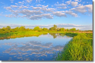
Stratocumulus clouds are similar to altocumulus clouds in their
fluffy appearance, but have a slightly darker shade due to their additional mass.
A good way to distinguish the two cloud types is to hold your hand out and measure
the size of an individual cloud; if it is the size of your thumb it is generally
an altocumulus cloud, if it is the size of your hand it is generally a
stratocumulus cloud.
It is uncommon for stratocumulus clouds to produce precipitation, but if they do
it is usually a light rain or snow.
Next Topic: Stratus Clouds
Weather Topic: What are Wall Clouds?
Home - Education - Cloud Types - Wall Clouds
 Next Topic: Altocumulus Clouds
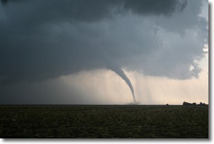
A wall cloud forms underneath the base of a cumulonimbus cloud,
and can be a hotbed for deadly tornadoes.
Wall clouds are formed by air flowing into the cumulonimbus clouds, which can
result in the wall cloud descending from the base of the cumulonimbus cloud, or
rising fractus clouds which join to the base of the storm cloud as the wall cloud
takes shape.
Wall clouds can be very large, and in the Northern Hemisphere they generally
form at the southern edge of cumulonimbus clouds.
Next Topic: Altocumulus Clouds
Current conditions powered by WeatherAPI.com


