Weather Alert in Minnesota
Air Quality Alert issued July 11 at 3:00PM CDT by NWS La Crosse WI
AREAS AFFECTED: Wabasha; Dodge; Olmsted; Winona; Mower; Fillmore; Houston
DESCRIPTION: * WHAT...The Minnesota Pollution Control Agency has issued an Air Quality Alert for fine particles pollution. The Air Quality Index (AQI) is expected to reach the Red or Unhealthy category. * WHERE...Southeast Minnesota. * WHEN...Until 9 AM CDT Monday. * IMPACTS...Some members of the general public may experience health effects. Sensitive groups, such as people with lung disease (including asthma), heart disease, and children and older adults, may experience health effects. * ADDITIONAL DETAILS...Heavy ground-level smoke from wildfires in central Canada moved into northwest Minnesota early Friday morning behind a cold front. This first band of smoke is currently impacting northern Minnesota as it moves east during the day Friday. Air quality will worsen across northeast Minnesota Friday evening as smoke arrives over the region. A second round of smoke will move into northwest Minnesota late Friday evening. This smoke will be more widespread as it moves southeast overnight, and by Saturday afternoon the entire state may be impacted. The heaviest smoke on Saturday will be across the northern half of the state. Air quality will begin to improve across western Minnesota Sunday morning as cleaner air moves in from the west. By Sunday evening, the smoke should be gone from most of the state. Another round of smoke is possible across far northern Minnesota Sunday night.
INSTRUCTION: Sensitive groups, such as people with lung disease (including asthma), heart disease, and children and older adults, should avoid prolonged or heavy exertion. The general public should limit prolonged or heavy exertion. Reduce or eliminate activities that contribute to air pollution, such as outdoor burning, and use of residential wood burning devices. Reduce vehicle trips and vehicle idling as much as possible. Keep windows closed overnight to prevent smoke from getting indoors.
Want more detail? Get the Complete 7 Day and Night Detailed Forecast!
Current U.S. National Radar--Current
The Current National Weather Radar is shown below with a UTC Time (subtract 5 hours from UTC to get Eastern Time).

National Weather Forecast--Current
The Current National Weather Forecast and National Weather Map are shown below.

National Weather Forecast for Tomorrow
Tomorrow National Weather Forecast and Tomorrow National Weather Map are show below.

North America Water Vapor (Moisture)
This map shows recent moisture content over North America. Bright and colored areas show high moisture (ie, clouds); brown indicates very little moisture present; black indicates no moisture.

Weather Topic: What are Cumulus Clouds?
Home - Education - Cloud Types - Cumulus Clouds
 Next Topic: Drizzle
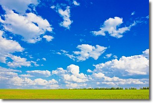
Cumulus clouds are fluffy and textured with rounded tops, and
may have flat bottoms. The border of a cumulus cloud
is clearly defined, and can have the appearance of cotton or cauliflower.
Cumulus clouds form at low altitudes (rarely above 2 km) but can grow very tall,
becoming cumulus congestus and possibly the even taller cumulonimbus clouds.
When cumulus clouds become taller, they have a greater chance of producing precipitation.
Next Topic: Drizzle
Weather Topic: What is Evaporation?
Home - Education - Precipitation - Evaporation
 Next Topic: Fog
Evaporation is the process which returns water from the earth
back to the atmosphere, and is another crucial process in the water cycle.
Evaporation is the transformation of liquid into gas, and it happens because
molecules are excited by the application of energy and turn into vapor.
In order for water to evaporate it has to be on the surface of a body of water.
Next Topic: Fog
Current conditions powered by WeatherAPI.com


