Weather Alerts for California
1. Air Quality Alert for: Calabasas and Agoura Hills; Eastern San Fernando Valley; Eastern San Gabriel Mountains; Eastern Santa Monica Mountains Recreational Area; Interstate 5 Corridor; Los Angeles County Beaches; Los Angeles County Inland Coast including Downtown Los Angeles; Los Angeles County San Gabriel Valley; Santa Clarita Valley; Santa Susana Mountains; Western San Fernando Valley; Western San Gabriel Mountains and Highway 14 Corridor; Western Santa Monica Mountains Recreational Area
2. Air Quality Alert for: San Bernardino and Riverside County Valleys-The Inland Empire; San Bernardino County Mountains; Riverside County Mountains; Santa Ana Mountains and Foothills; Coachella Valley; San Gorgonio Pass Near Banning; Orange County Inland
3. Extreme Heat Warning for: Coachella Valley; San Diego County Deserts; San Gorgonio Pass Near Banning
4. Extreme Heat Warning for: Joshua Tree NP West; Joshua Tree NP East; Imperial County Southwest; Salton Sea; Chuckwalla Mountains; Imperial County Southeast; Imperial County West; Imperial Valley; Chiriaco Summit; Palo Verde Valley; Chuckwalla Valley
5. Heat Advisory for: Riverside County Mountains; San Diego County Mountains
6. Heat Advisory for: San Bernardino and Riverside County Valleys-The Inland Empire
7. Heat Advisory for: San Diego County Inland Valleys
8. Wind Advisory for: Santa Barbara County Southwestern Coast; Santa Ynez Mountains Western Range
Want more detail? Get the Complete 7 Day and Night Detailed Forecast!
Current U.S. National Radar--Current
The Current National Weather Radar is shown below with a UTC Time (subtract 5 hours from UTC to get Eastern Time).

National Weather Forecast--Current
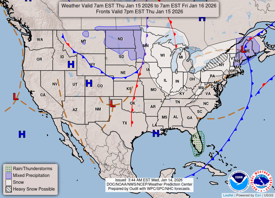
The Current National Weather Forecast and National Weather Map are shown below.

National Weather Forecast for Tomorrow
Tomorrow National Weather Forecast and Tomorrow National Weather Map are show below.
North America Water Vapor (Moisture)
This map shows recent moisture content over North America. Bright and colored areas show high moisture (ie, clouds); brown indicates very little moisture present; black indicates no moisture.

Weather Topic: What are Mammatus Clouds?
Home - Education - Cloud Types - Mammatus Clouds
 Next Topic: Nimbostratus Clouds
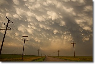
A mammatus cloud is a cloud with a unique feature which resembles
a web of pouches hanging along the base of the cloud.
In the United States, mammatus clouds tend to form in the warmer months, commonly
in the Midwest and eastern regions.
While they usually form at the bottom of a cumulonimbis cloud, they can also form
under altostratus, altocumulus, stratocumulus, and cirrus clouds. Mammatus clouds
warn that severe weather is close.
Next Topic: Nimbostratus Clouds
Weather Topic: What is Precipitation?
Home - Education - Precipitation - Precipitation
 Next Topic: Rain
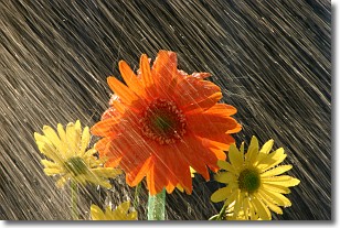
Precipitation can refer to many different forms of water that
may fall from clouds. Precipitation occurs after a cloud has become saturated to
the point where its water particles are more dense than the air below the cloud.
In most cases, precipitation will reach the ground, but it is not uncommon for
precipitation to evaporate before it reaches the earth's surface.
When precipitation evaporates before it contacts the ground it is called Virga.
Graupel, hail, sleet, rain, drizzle, and snow are forms of precipitation, but fog
and mist are not considered precipitation because the water vapor which
constitutes them isn't dense enough to fall to the ground.
Next Topic: Rain
Current conditions powered by WeatherAPI.com